Sacramento Valley – Colusa
Statistics
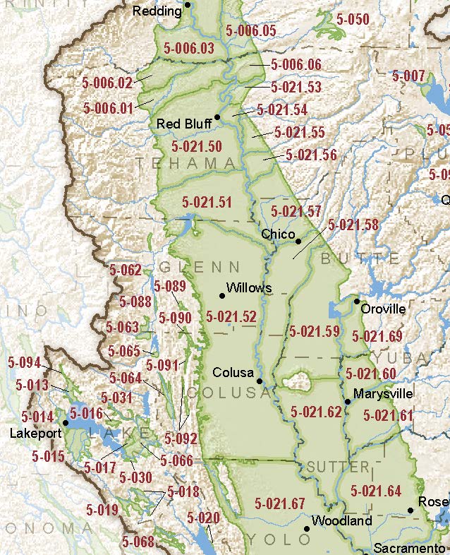
- Basin Name
- Sacramento Valley – Colusa
- Basin Number
- 5-021.52
- SGMA Basin Priority
- High
- Critically Overdrafted
- No
- Hydrologic Region Name
- Sacramento River
- Counties
- Colusa, Glenn, Plumas, Tehama, Yolo
- Adjacent Basins
At-A-Glance
Located in California’s Sacramento River hydrologic region, the Sacramento Valley – Colusa subbasin is 723,823.74 acres in size. This High priority basin is home to an estimated 43,775 people (2010 value). It has approximately 6,092 wells, of which approximately 88 are public supply wells. Groundwater accounts for approximately 37 percent of the basin’s water supply.
Basin Notes
2003: Bulletin 118 basin description
2014: Basin prioritization – medium. Comments: Severely declining GW levels along the west-side of Glenn Co. Moderately declining GW levels in the Capay area. High TDS shallow aquifer in Maxwell- Williams area. Increase in housing development along I5. GW-SW interaction is important to maintaining waterfowl refuges. Area is being highlighted as solution area for Delta outflow issues…proposed increase in CU and GW pumping.
2016: Basin boundary modification
Revised basin boundary description
2018: Priority – high Per 2018 draft basin prioritization: Groundwater-related transfer “Type A” in which local groundwater is pumped to compensate for exported supply Butte County basin boundary/consolidation request for Colusa and the Wyandotte Creek 5-021.69, Corning 5-021.51, Vina 5-021.57, West Butte 5-021.58, East Butte 5-021.59, Sutter 5-021.62 subbasins pending Basin boundary modification approved. Per DWR: It “revises the central-easterly boundary of the Colusa and West Butte subbasins to extend easterly to follow the western boundary of Reclamation District 1004. The revision places the Colusa Groundwater Authority wholly within the Colusa subbasin.” Phase 2 draft priority: high.
2022: January 28 – Groundwater Sustainability Plan submitted to DWR
2023: October 26 – DWR assessed the plan incomplete and gave the GSA 180 days to correct deficiencies.
December 11 – Addressing Groundwater Overdraft in the Sacramento Valley, Public Policy Institute of California