Owens Valley
Statistics
- Basin Name
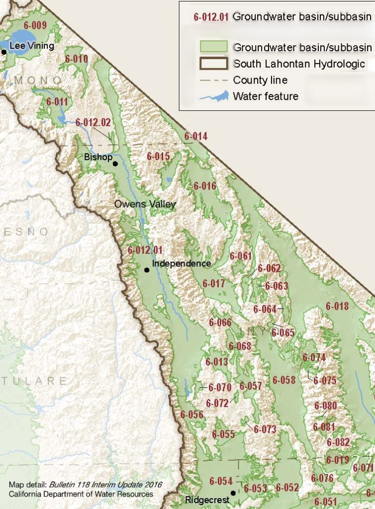
- Owens Valley
- Basin Number
- 6-012.01
- SGMA Basin Priority
- Low
- Critically Overdrafted
- No
- Hydrologic Region Name
- South Lahontan
- Counties
- Inyo, Mono
- Adjacent Basins
At-A-Glance
Located in California’s South Lahontan hydrologic region, the Owens Valley is 660,648.16 acres in size. This Low Priority basin is home to an estimated 17,648 people (2010 value). It has approximately 1,054 wells, of which approximately 130 are public supply wells. Groundwater accounts for approximately 84 percent of the basin’s water supply. 34.99% of Owens Valley is adjudicated and 65.01% is subject to SGMA.
Basin Notes
1972: As wells begin drying up, Inyo County sues for an Environmental Impact Report of Los Angeles water exports under the California Environmental Quality Act (CEQA). Inyo chronology of water disputes with City of Los Angeles and Los Angeles Department of Water and Power
1991: Basin 34.99% adjudicated. Watermaster/annual report page DWR.
1993: U.S. Environmental Protection Agency classed Owens Valley as a serious “non-attainment area” for dust storms in all or part caused by water withdrawals. Air quality now monitored by the Great Basin Unified Air Pollution Control District
2003: Bulletin 118 basin description
2014: CASGEM basin prioritization – medium. Comments – Minor impairments locally due to inorganics. Actual GW Volume not fully captured due to GW exports out of the basin. GW volume reflects the additional 100K AF of pumping that is exported. GW % is adjusted to reflect the additional pumping
2016: Basin boundary modification request – denied. Per DWR: The request did not provide adequate scientific information to support basin subdivision at the Mono / Inyo County line. The observed gravity anomaly and associated geologic structure does not demonstrate a hydrogeologic barrier to groundwater flow. In addition, administrative edits were made to include a previously identified B-118 basin, “Fish Slough”, as a subbasin to Owens Valley. Basin boundary description
2018: Draft basin priority: High (at a rate that would qualify for critical overdraft in non-adjudicated basins). Declining groundwater level and adverse impacts comments:
- Declining groundwater level: CASGEM/WDL/GWIDS: Stable hydrographs. Source: DWR 2) LADWP hydrographers monitor groundwater levels in over 700 monitoring wells throughout the Owens Valley. As shown in Figures 3.2-3.10, groundwater levels are generally stable in most areas of the valley considering that hydrographs show groundwater levels following the four driest consecutive years since LADWP began keeping record of flows in Owens Valley. Source: Los Angeles Department of Water and Power 2016 Annual Owens Valley Report.
- Adverse Impacts 1) Evaluation of the hydrologic system and selected water-management lternatives in the Owens Valley: 1) Details and modeling results demonstrating impacts to surface habitat and stream flow from pumping. 2) Subbasin dependencies with 6-012.02. Most of the ground water from Chalfant, Hammil, and Benton Valleys is believed to enter the Bishop Basin near Fish Slough beneath the southeastern part of the Volcanic Tableland
- Priority set to High because of out-of-basin exports. Valley considered a “Type B” basin, defined per DWR: “Out-of-basin groundwater transfers are transfers that pump percolating groundwater from a source basin and convey the pumped water to a location outside the source basin to be used in ways that does not benefit the source basin. Basin Prioritization refers to these transfers as Type B.”
Pending basin boundary modification request to exclude Starlite Estates and McGee Meadow Los Angeles Department of Water & Power 2018 Annual Owens Valley Report
2019: Basin boundary modification. Per DWR: “The basin boundary modification revises a minor portion of the external boundary of Owens Valley basin near Starlite Community Services District and McGee Meadows. The existing area mapped as alluvium was shown to contain glacial till, which is not considered alluvium. The agency submitted sufficient scientific evidence to support an external boundary modification.”
2021: Owens Valley Groundwater approved a GSP to comply with SGMA
2022: Owens Valley Groundwater Sustainability Plan submitted to DWR