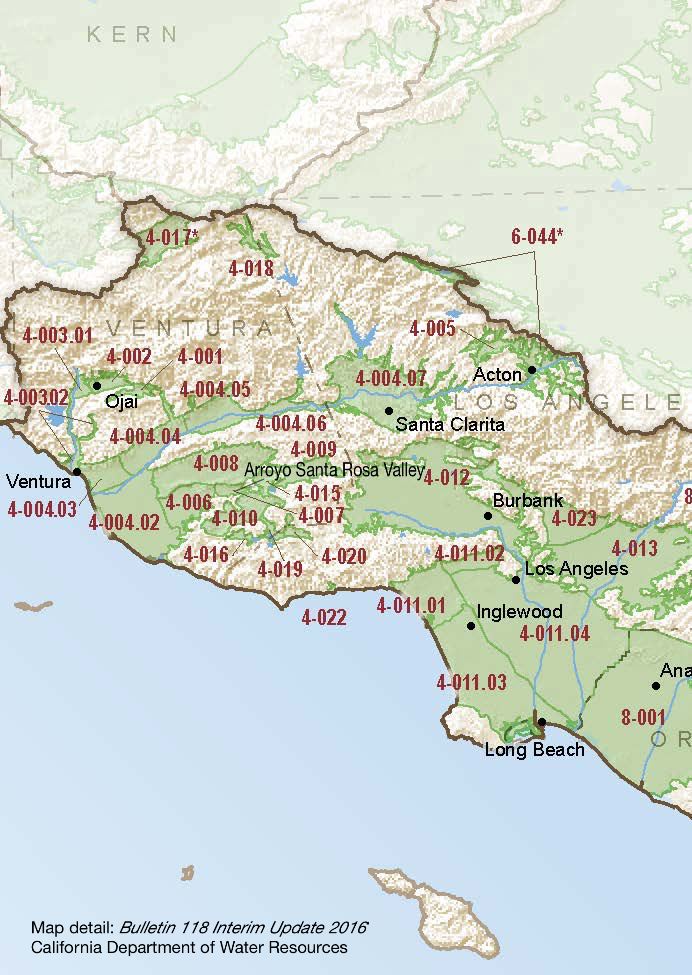
Arroyo Santa Rosa Valley
Statistics
- Basin Name
- Arroyo Santa Rosa Valley
- Basin Number
- 4-007
- SGMA Basin Priority
- Very Low
- Critically Overdrafted
- No
- Hydrologic Region Name
- South Coast
- Counties
- Ventura
- Adjacent Basins
At-A-Glance
Located in California’s South Coast hydrologic region, the Arroyo Santa Rosa Valley is 3,924.27 acres in size. This Very Low priority basin is home to an estimated 2,434 people (2010 value). It has approximately 58 wells, of which approximately 4 are water supply wells. Groundwater accounts for approximately 74 percent of the basin’s water supply.
Basin Notes
2003: Bulletin 118 basin description
2014: CASGEM basin prioritization – medium. Note: Elevated sulfates, nitrates and TDS in the basin.
2018: Draft basin prioritization – Very Low. Note: 1) CASGEM/WDL/GWIDS: No data or data insufficent to determine GWL status. Source: DWR 2) GWMP says overdrafted in 1970s, mitigated for it and GWLs have been relatively stable since. Hydrographs show relatively stable hydrographs. Basin boundary modification request.
2019: Basin boundary modification approved. Per DWR: It “follows geologic contacts on a qualified map. The modification increases the boundary’s accuracy by delineating the extent of alluvium on a more detailed scale than previously mapped, and it more accurately incorporates water- bearing formations into the Arroyo Santa Rosa Valley basin. The requesting agency supplies sufficient information to support the scientific rationale for the modification. The request meets regulatory requirements.”
Draft priority: Very Low.